
Introduction
This new study is a continuation of our earlier work, “Report on GNSS Interference in the Baltic Sea: Analysis Using a Terrestrial Monitoring System and Comparison with ADS-B Data.” In that previous six-month investigation, conducted from a fixed sensor installed at the Gdynia Maritime University campus, we documented persistent multi-constellation jamming, as well as indications of mobile maritime interference sources operating in the region.
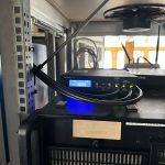
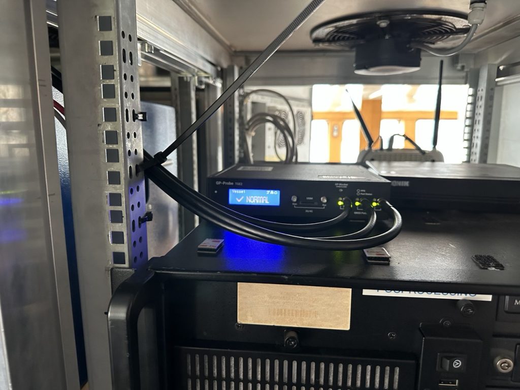
In the present phase of research, we moved beyond land-based monitoring and installed our GP-Probe TGE2 interference sensor directly on board a research vessel. This ship operated throughout the southern Baltic Sea, including regular approaches toward the maritime boundary of the Kaliningrad region. By placing the sensor on a moving platform rather than a coastal location, we were able to record GNSS interference exactly as it affects real vessels—capturing signal conditions that cannot be observed from shore due to differences in radio horizon, antenna orientation, multipath environment, and proximity to potential interference sources.

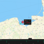
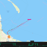

Between 23 June and 14 October 2025, the vessel conducted multiple offshore measurement campaigns, routinely leaving the Port of Gdańsk and performing extended maneuvers in open water. This shipborne dataset provides a far more accurate representation of the true GNSS environment experienced by maritime operators in the Gulf of Gdańsk. It also reveals a level of interference complexity and intensity that was not visible in the previous coastal study.
Key Findings
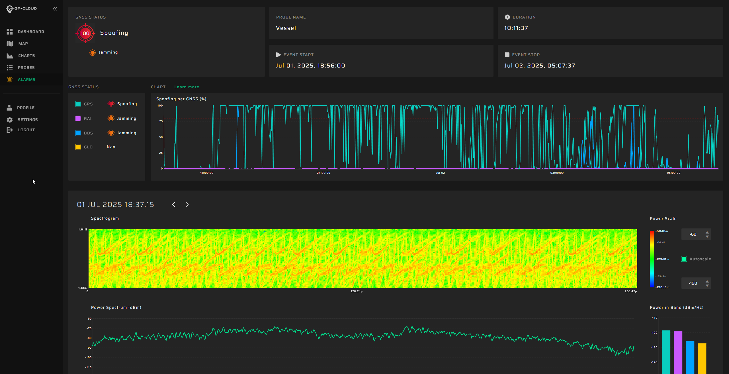
1. Transition from Classical Jamming to Combined Spoofing–Jamming Interference
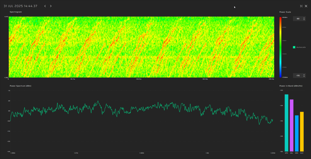
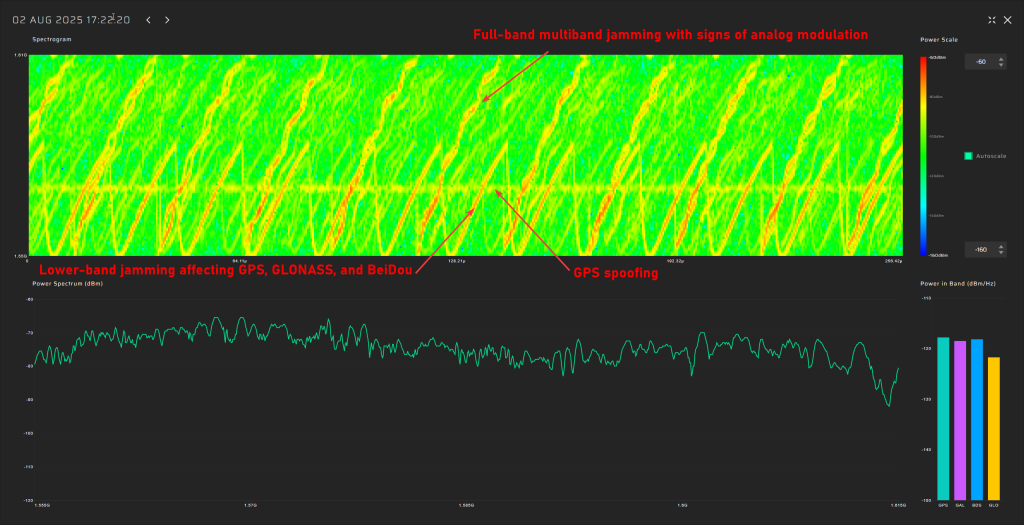
In contrast to the previous six-month coastal study, where all recorded GNSS interference consisted exclusively of multi-constellation jamming, the current shipborne campaign reveals a fundamentally different interference landscape.
All major events now present a dual-layer structure composed of:
- GPS L1 spoofing, generating forged satellite-like signals, and
- Simultaneous jamming of GLONASS, Galileo, and BeiDou.
This combined architecture forces GNSS receivers to rely solely on spoofed GPS signals while denying access to independent ranging sources. The practice is consistent with commonly used operational strategies: spoofing only one constellation (GPS) drastically reduces system complexity and cost, whereas spoofing all GNSS systems would require multiple parallel RF chains, SDR-based generators, algorithms for signal simulations and amplifiers.
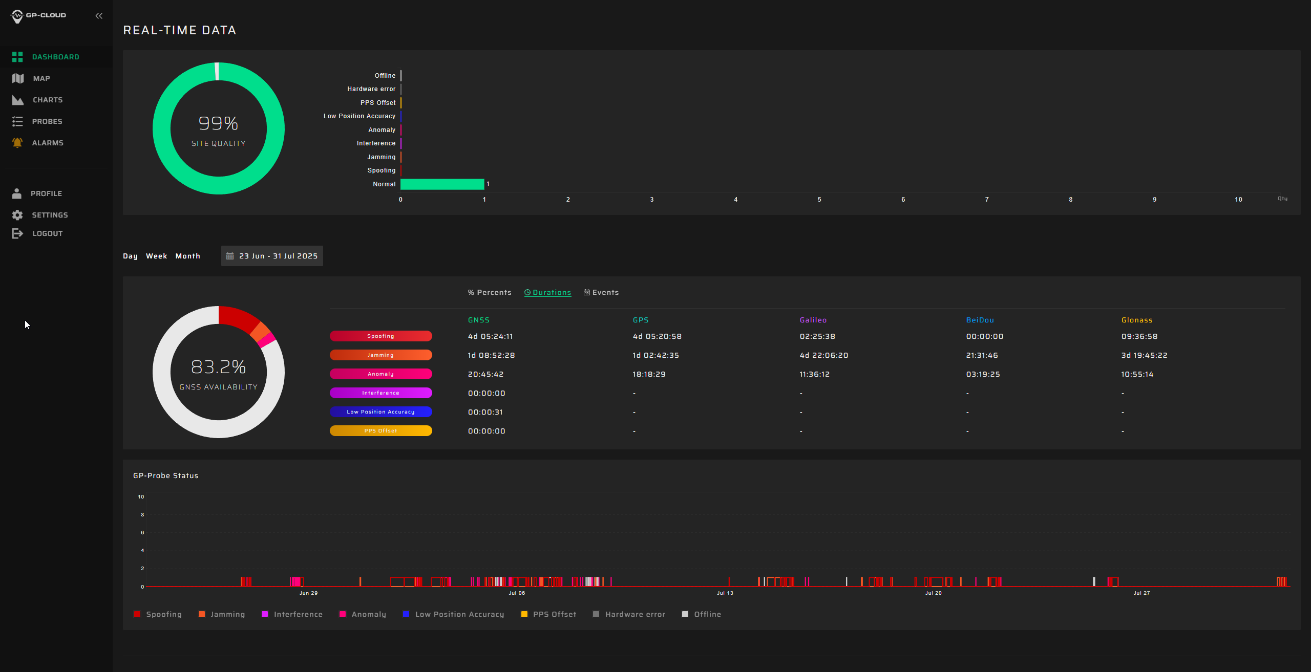
2. Highest Recorded Levels of GNSS Disruption
The most severe interference period occurred from late June through July, during which:
- GNSS availability dropped to 83.5%,
- 4 days, 5 hours, and 24 minutes of spoofing were recorded—by far the highest cumulative spoofing activity of the entire campaign.
The single most extreme incident took place between 1 and 3 July, with nearly 30 consecutive hours of spoofing within a 48-hour interval, posing a severe risk for maritime navigation.
In subsequent months the interference intensity gradually decreased, yet low-power and short-duration events continued to be observed.
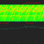
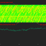
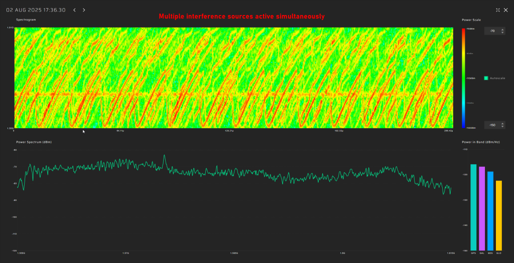
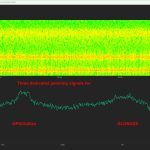
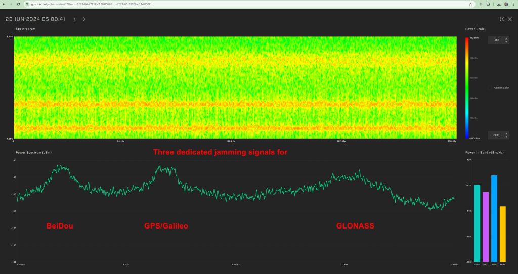
3. A Multi-Emitter, Synchronously Operating Interference Network
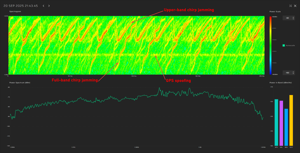
Spectrogram analysis reveals that the interference does not originate from a single source but from four distinct, technologically different emitters operating in coordination:
- GPS spoofing transmitter generating forged L1 signals.
- Lower-band chirp jammer suppressing GPS, Galileo, and BeiDou.
- Upper-band chirp jammer suppressing GLONASS G1 only.
- Full-band analog-like broadband jammer covering the entire 60 MHz GNSS L1 band.
The synchronous activation and termination of all four components indicate a centrally coordinated system, yet their differing spectral signatures, bandwidths, and stability levels confirm multiple spatially separated stations rather than a single unified installation.
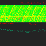

4. Evolution of Interference Modulation Techniques
A clear shift is observed compared to the previous study :
- Previously, the dominant interference source consisted of a high-quality, purpose-engineered wideband signal with three clean constellation-matched components—an indication of modern, precisely designed jamming equipment.
- In the current campaign, the prevailing interference is simpler wideband chirp jamming, a less advanced technique but deployed at significantly higher power levels.
- The wideband analog-like component further shows pronounced parasitic frequency fluctuations, characteristic of older low-stability RF hardware.
This indicates a shift from high-precision jamming to a mixed environment of legacy high-power systems combined with newer spoofing capabilities.
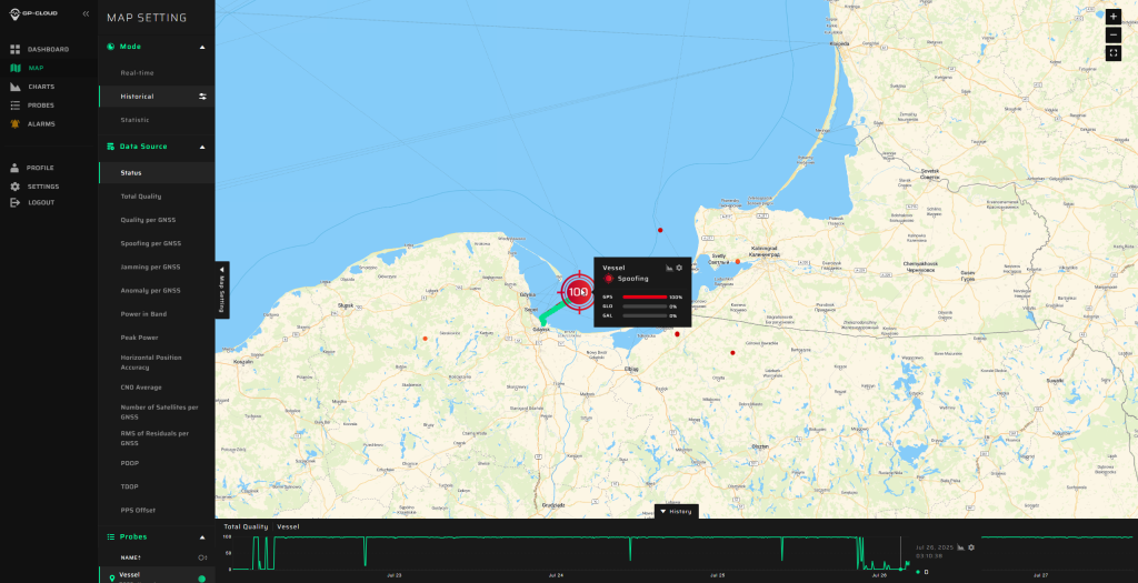
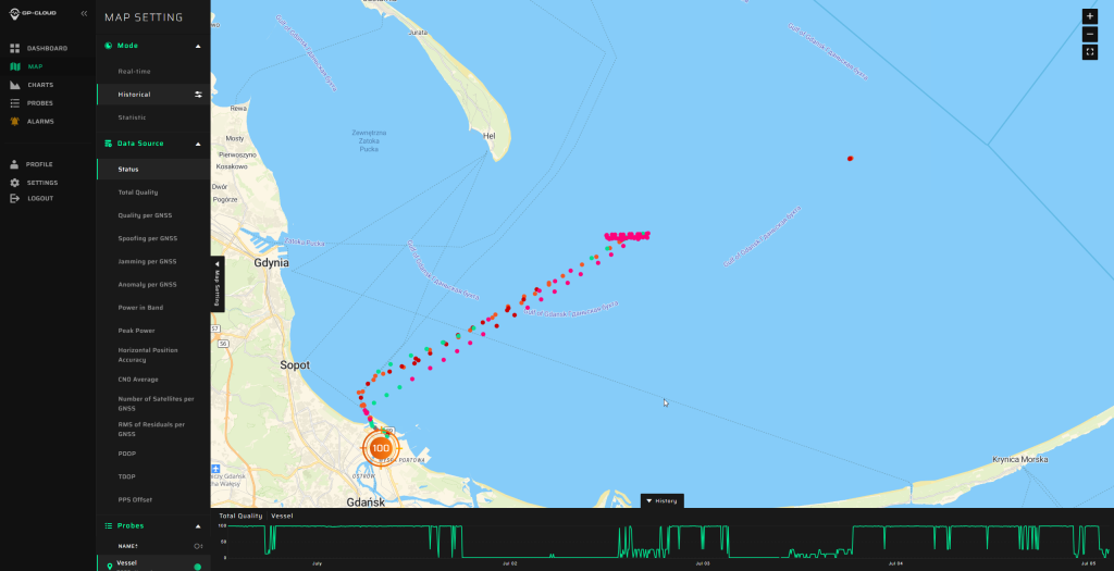
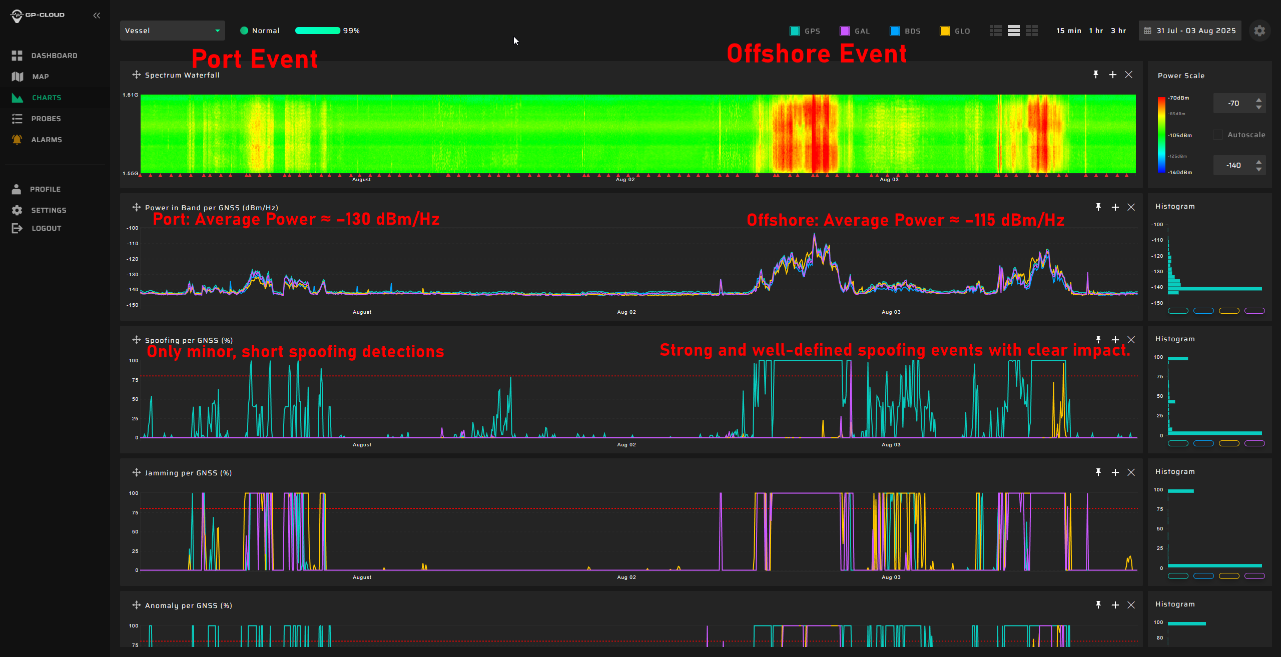
5. Interference Strongly Intensifies Offshore
A distinct spatial gradient was recorded:
- In the Port of Gdańsk, interference appears weak or barely detectable.
- As the vessel moves into open water, the same signals become up to 15 dB stronger.
- The interference power consistently increases when approaching the waters facing Kaliningrad.
This pattern shows that—intentionally or not—the interference system affects maritime traffic far more than coastal infrastructure, with the operational impact being greatest in offshore navigational zones.
Schedule a Meeting and Access Live/Raw Data
Our shipborne GNSS interference sensor remains fully active on the research vessel, continuously collecting real-time data in the Gulf of Gdańsk. If you would like to see current interference conditions near the Kaliningrad maritime border, we can provide live demonstrations during an online meeting.
We invite you to book a session with our team.
During the meeting, we will:
- present the key results of the campaign,
- walk you through the measurement data and spectrograms,
- demonstrate real-time GNSS interference observations (if the vessel is underway),
- discuss your operational needs and analytical requirements, and
- explore options for granting you access to raw measurement data and GP-Cloud, where you can perform your own independent analysis.
If your organization is interested in deeper collaboration or continuous monitoring, we will also outline the available technical integration options and data delivery formats.
Please book a meeting at your convenience, and we will prepare a tailored demonstration based on your needs.
